|
||
|
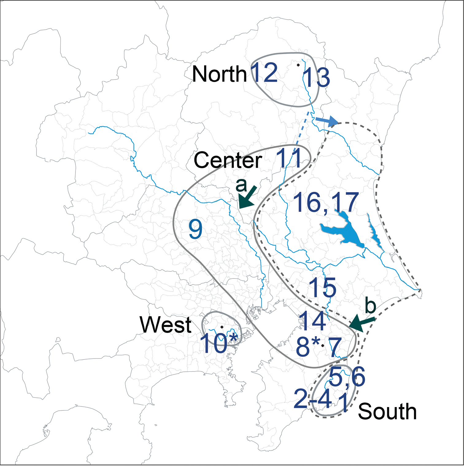
Geographic grouping of localities (encircled by gray solid lines) and river connectivity in 16th century (blue solid lines). Gray broken line encircles localities with the South geographic group including newly found localities (#15–17). Another newly found locality (#14) could be a member of the Center geographic group, but its haplotype composition is not typical among localities of the group. Arrows a and b denote historical overflow or stream capture terrains between river basins. Blue broken line indicates ancient river flow, and a blue arrow denotes change of the river flow at 500 ka. |