|
||
|
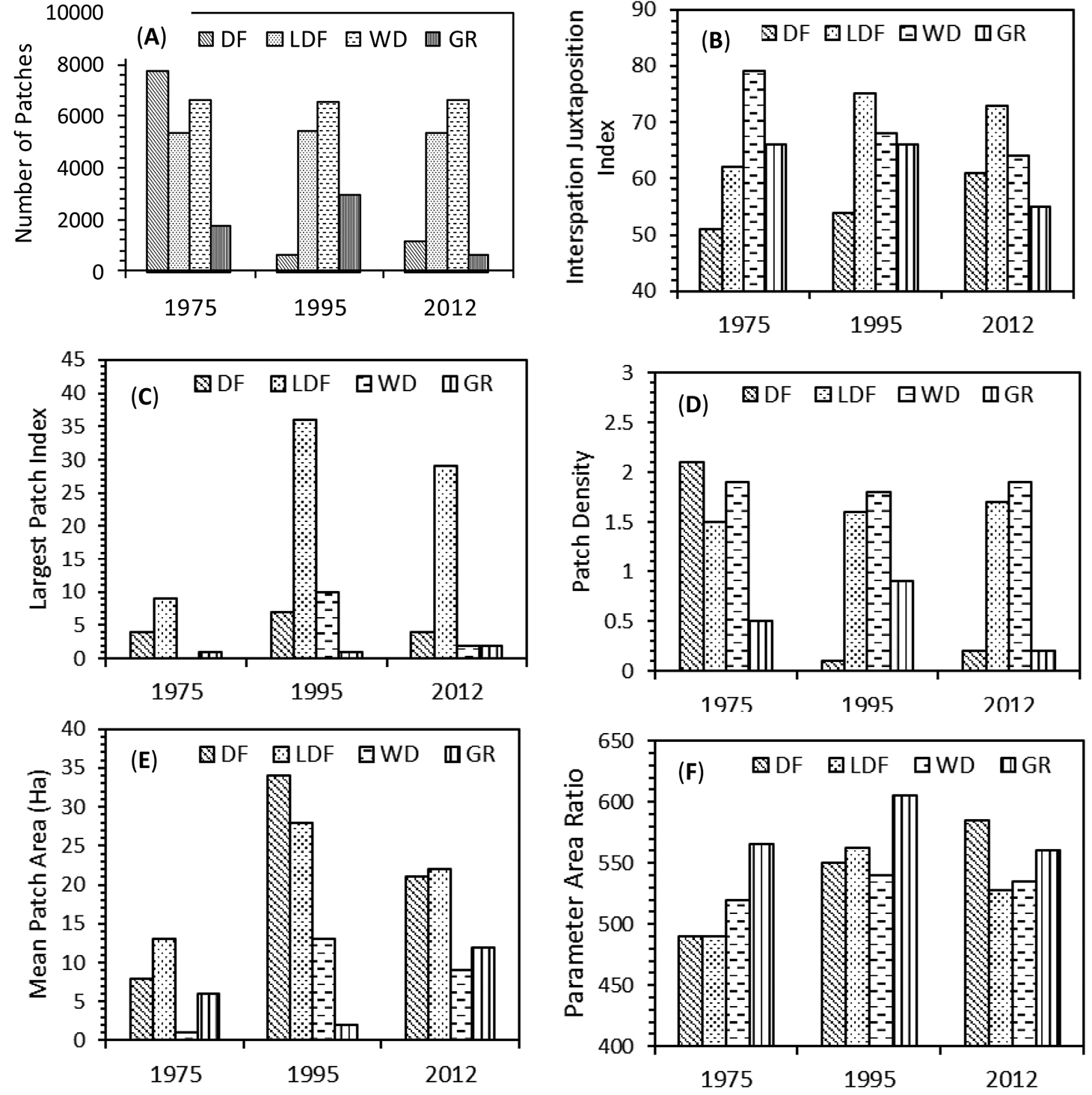
Spatial variability in number of patches (A), Interspersion Juxtaposition Index (B), Largest patch index (C), Patch density (D), Mean patch area (E) and Perimeter area ratio (F) in 1975, 1995, and 2012. DF - dense forest, LDF - less dense forest, WD - woodland, GR - grassland. |