|
||
|
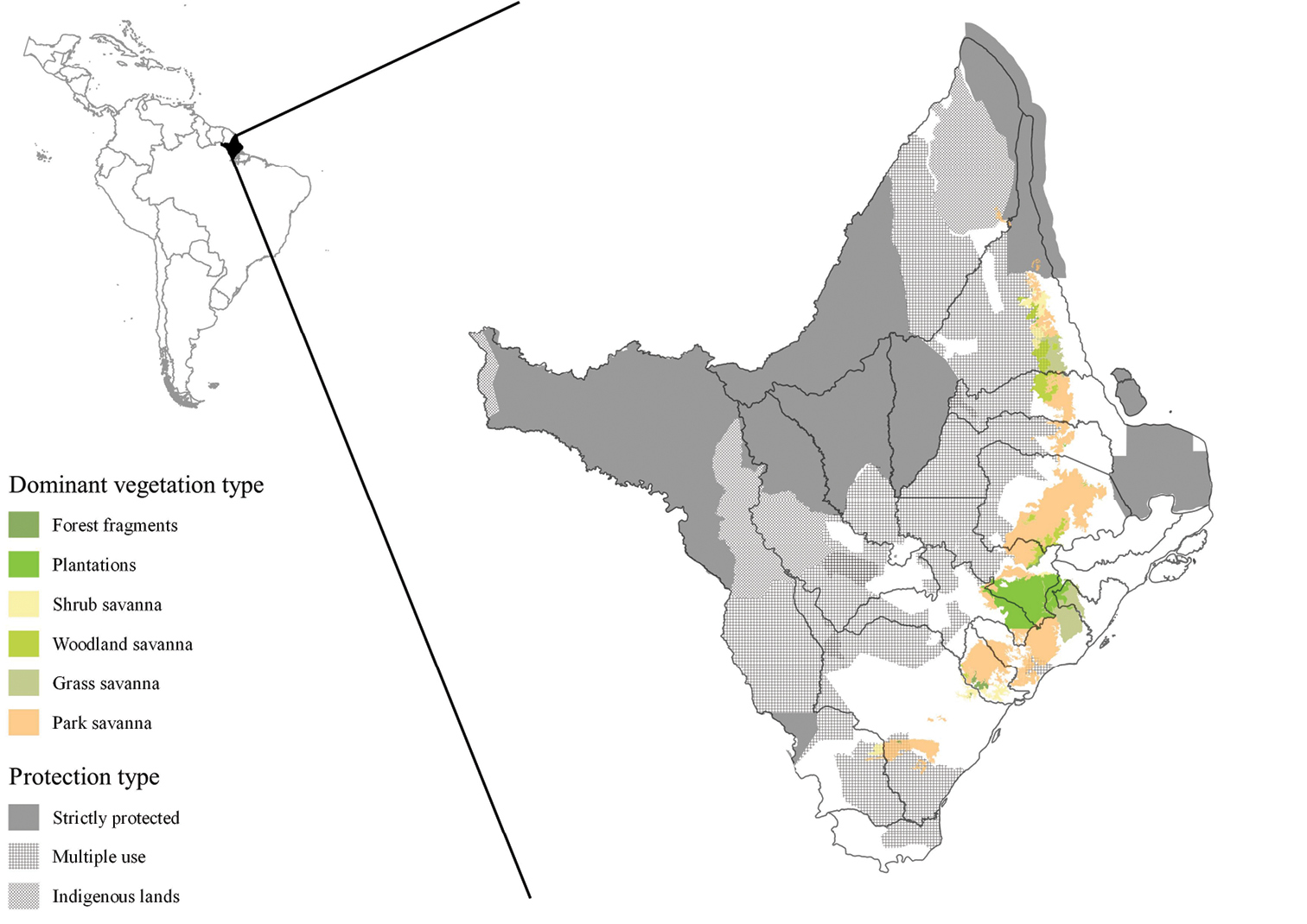
Spatial distribution of dominant savanna types and protected areas in the state of Amapá. Distribution of the four dominant savanna vegetation types (based on the Brazilian Institute of Geography and Statistics (IBGE) vegetation cover map for the Amazon (IBGE 2004a), and the three categories of protected areas (based on the shapefiles of Conservation Units and Indigenous Lands available from the Amapá State Environmental Secretariat (SEMA-AP 2016) and the World Database on Protected Areas (IUCN and UNEP-WCMC 2016) in the state of Amapá. Solid grey lines show the limits of the sixteen municipalities that make up the state. The shapefile of boundaries of the municipalities was also obtained from the Amapá State Environmental Secretariat. |