|
||
|
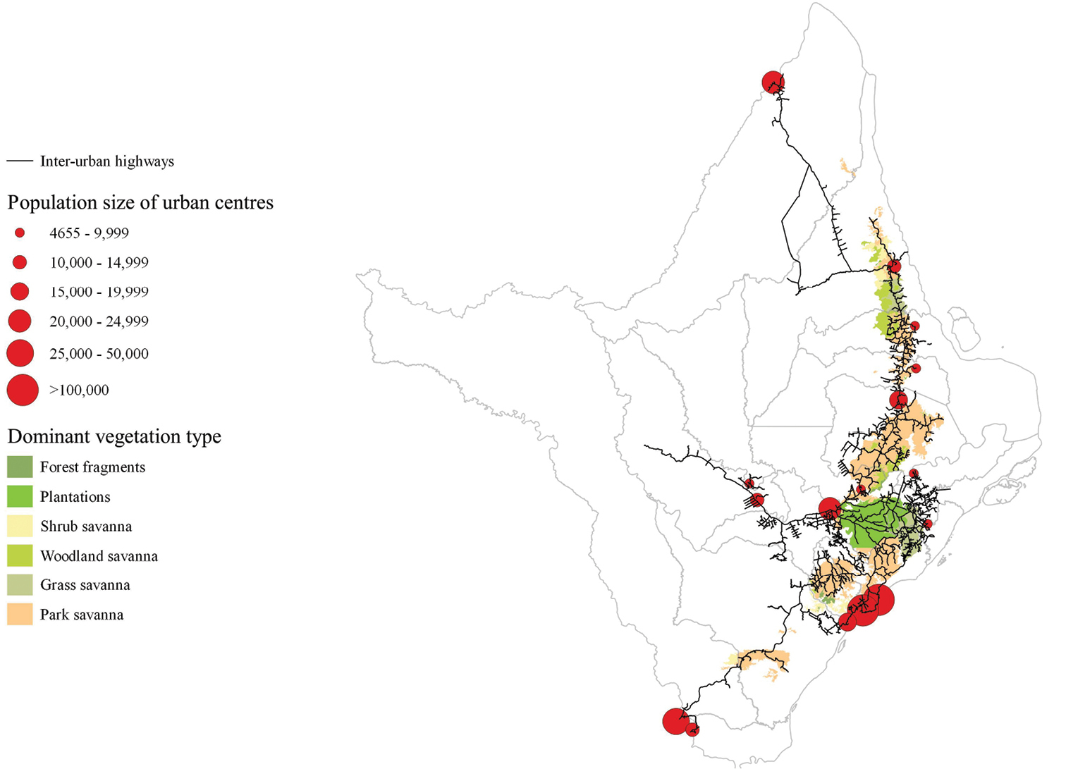
Highways and conurbations in the Cerrado of Amapá. The network of main highways (black lines), and municipal limits (grey lines) in the state of Amapá obtained from the Amapá State Environmental Secretariat (SEMA-AP 2016). The total length of highways in the state is 3,578.5 km, of which 1,999.9 km (55.9%) is within the Cerrado of Amapá. Of the 16 urban centres, 11 are within 10 km of the Cerrado of Amapá (points, with the size of the point proportional to the population – information obtained from IBGE (2016)). |