|
||
|
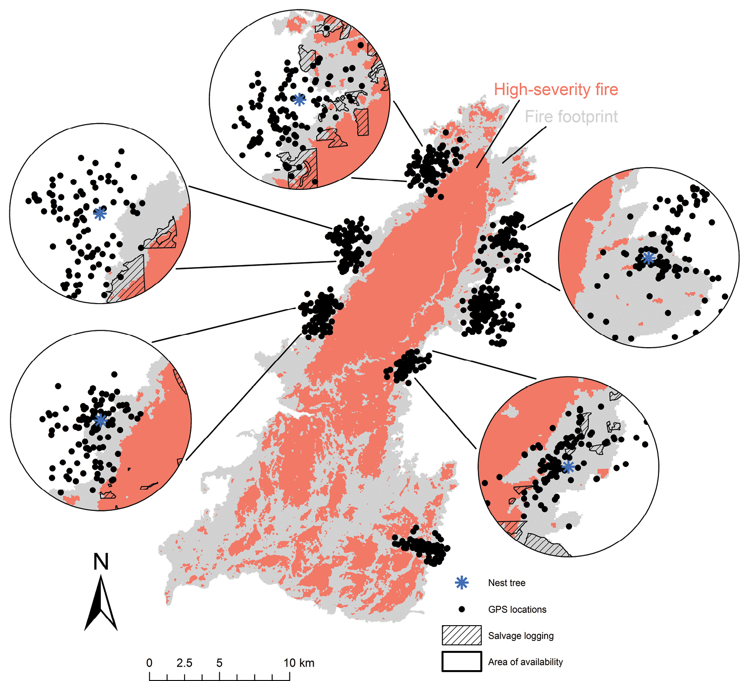
Spotted owl movement patterns in and around the 2014 King Fire. Locations of spotted owl foraging activities that were collected in 2015 are represented by black dots. The King Fire extent (footprint) is shown in grey and high-severity fire (> 75% canopy mortality) is shown in orange. The locations of known post-fire salvage logging operations on private lands that occurred prior to the end of data collection in 2015 are shown using black hatch marking (displayed in the inset examples). Large patches of high-severity-burned forest (orange) within spotted owl foraging ranges are clearly avoided. Data from Jones et al. (2016), but the graphical presentation here is different. |