|
||
|
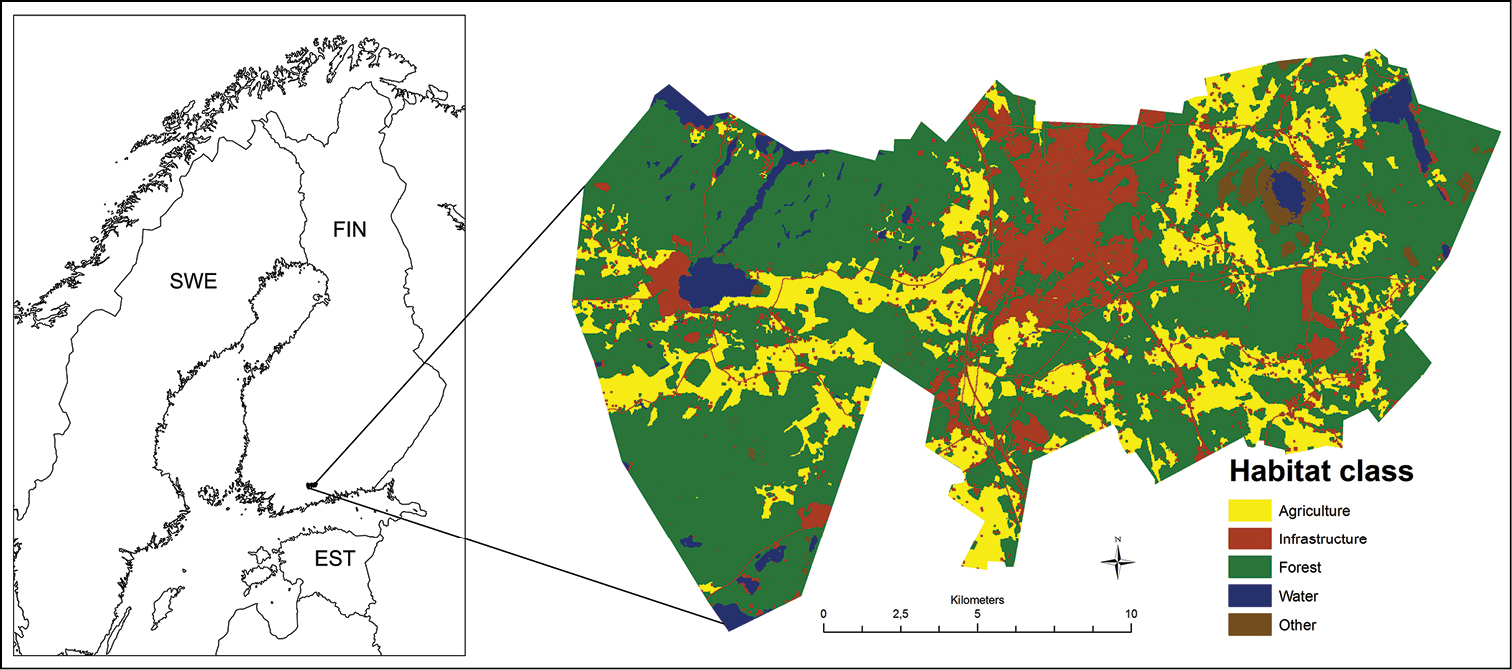
The map of our study area. The land use map is simplified from CORINE Land Cover 2006 data (Finnish Environment Institute 2009, CLC2006). Country borders: Eurostat. |
|
||||||||
| Part of: Niemi M, Matala J, Melin M, Eronen V, Järvenpää H (2015) Traffic mortality of four ungulate species in southern Finland. In: Seiler A, Helldin J-O (Eds) Proceedings of IENE 2014 International Conference on Ecology and Transportation, Malmö, Sweden. Nature Conservation 11: 13–28. https://doi.org/10.3897/natureconservation.11.4416 |