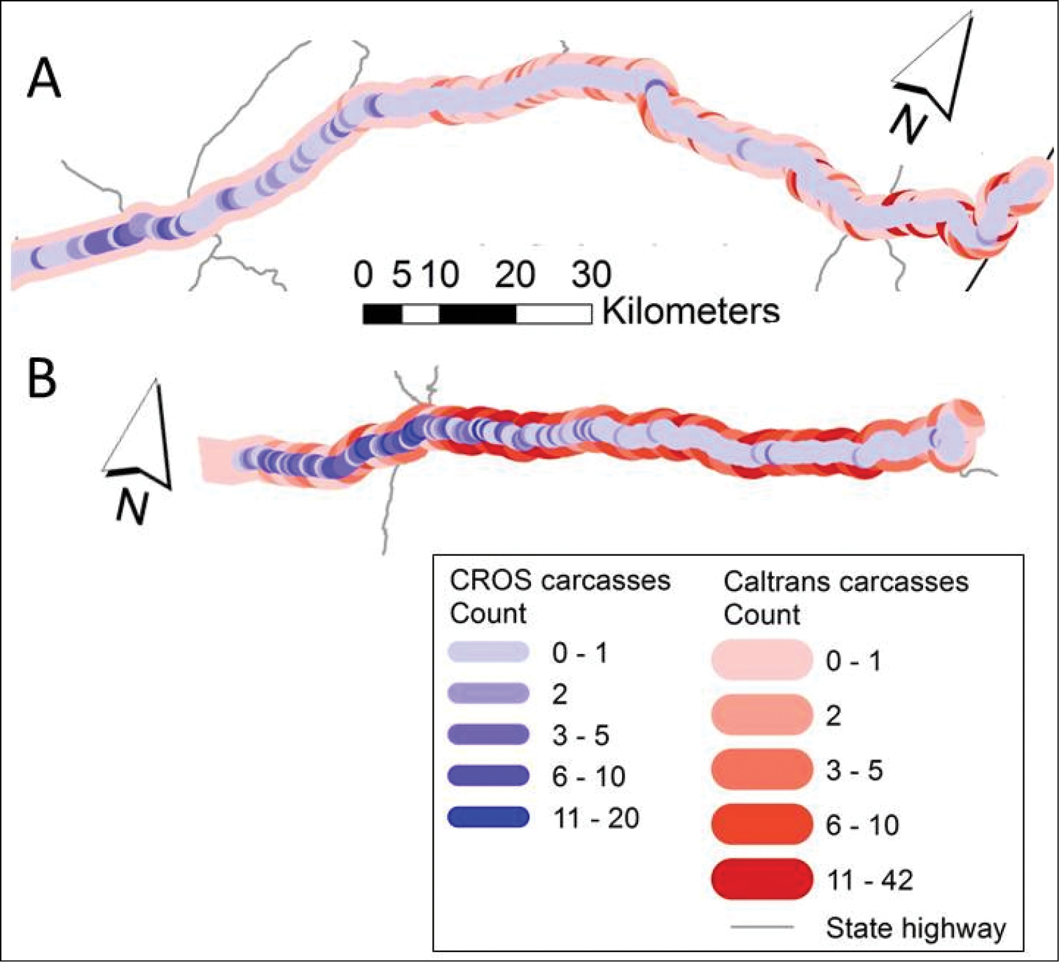
Comparison of state agency and volunteer-collected data-based hotspots. Carcasses reported in the CROS system (inner blue-range segments) overlaid with carcasses reported in the Caltrans system (outer red-range segments) along CA-80 (A) and along CA-50 (B).


  Part of: Shilling FM, Waetjen DP (2015) Wildlife-vehicle collision hotspots at US highway extents: scale and data source effects. In: Seiler A, Helldin J-O (Eds) Proceedings of IENE 2014 International Conference on Ecology and Transportation, Malmö, Sweden. Nature Conservation 11: 41–60. https://doi.org/10.3897/natureconservation.11.4438