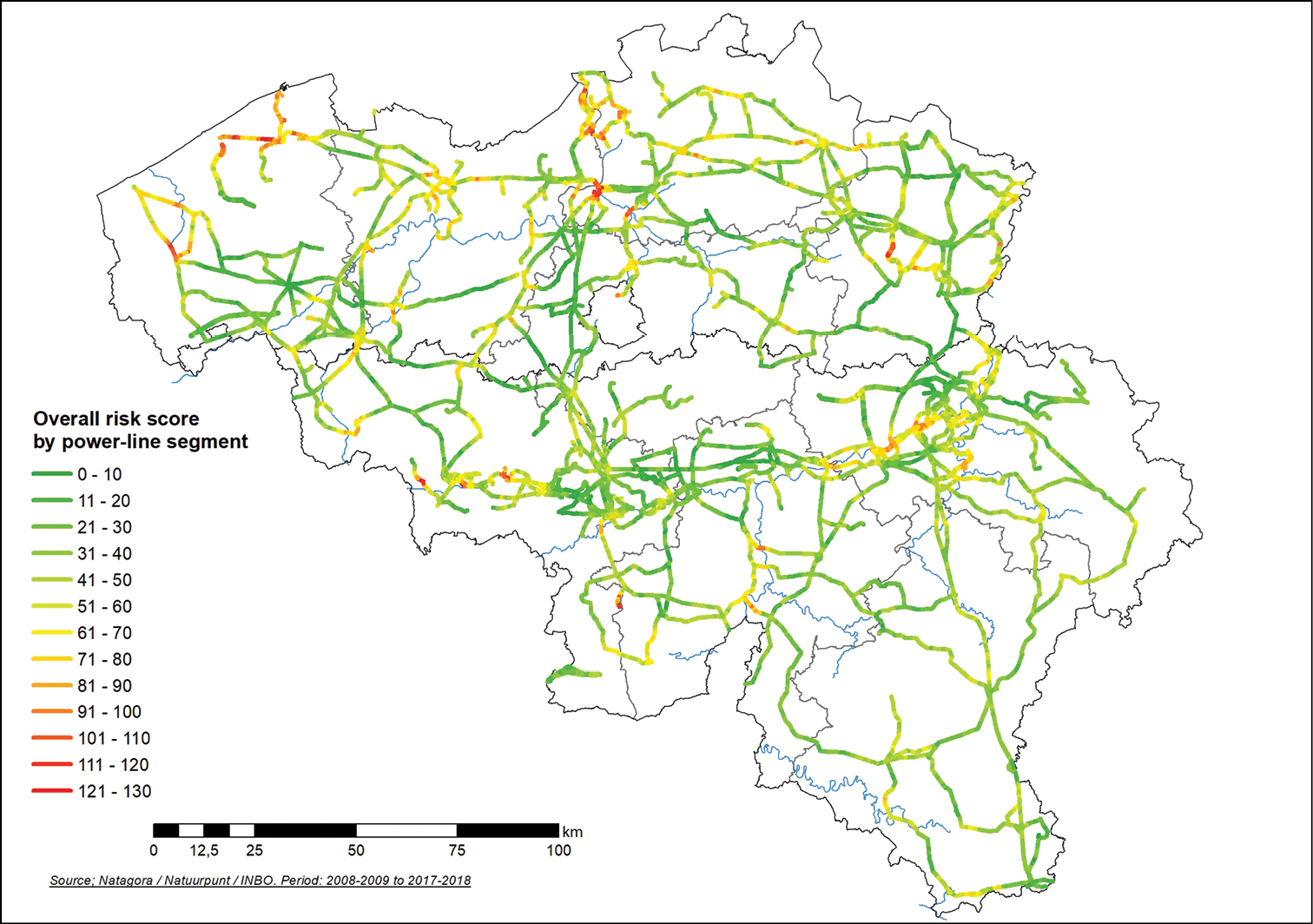
Map of the existing transmissions lines, colour-coded according to the bird collision risk they represent. Most of the high-priority lines are close to important waterbird sites, but numerous segments are also located in the central part of the country, in the historically industrial river valleys.


  Part of: Paquet J-Y, Swinnen K, Derouaux A, Devos K, Verbelen D (2022) Sensitivity mapping informs mitigation of bird mortality by collision with high-voltage power lines. In: Santos S, Grilo C, Shilling F, Bhardwaj M, Papp CR (Eds) Linear Infrastructure Networks with Ecological Solutions. Nature Conservation 47: 215-233. https://doi.org/10.3897/natureconservation.47.73710